

____Day 1. Starting at Hope. Starting with Hope. Hope I don't fall-off. Hope I don't get lost. Hope I don't get a puncture. Hope I'm fit enough for this sort of long-distance cycle tour. I give myself every advantage of an easy start by following the north bank of the Fraser River on Highway 7; west bound and downstream. Then five kilometres past Agassiz; a 1 in 10 climb has my lungs bursting. The campsite at Mission cannot come fast enough as an afternoon shower soaks me before I reach the trout farm/ campground.
____Hope's major claim to fame is that it was the back-drop to the finally of Sylvester Stallone's film: First Blood, where he played Johnny Rambo. The rivers Skagit and Coquihalla join the Fraser at Hope. Also the Trans-Canada Highway, along the Fraser Canyon; the four-lane highway down from the Coquihalla Pass and Highway 3, from the Crowsnest Pass, all converge at Hope. Thankfully a by-pass routes most of the traffic around the town, leaving the centre pretty quiet.
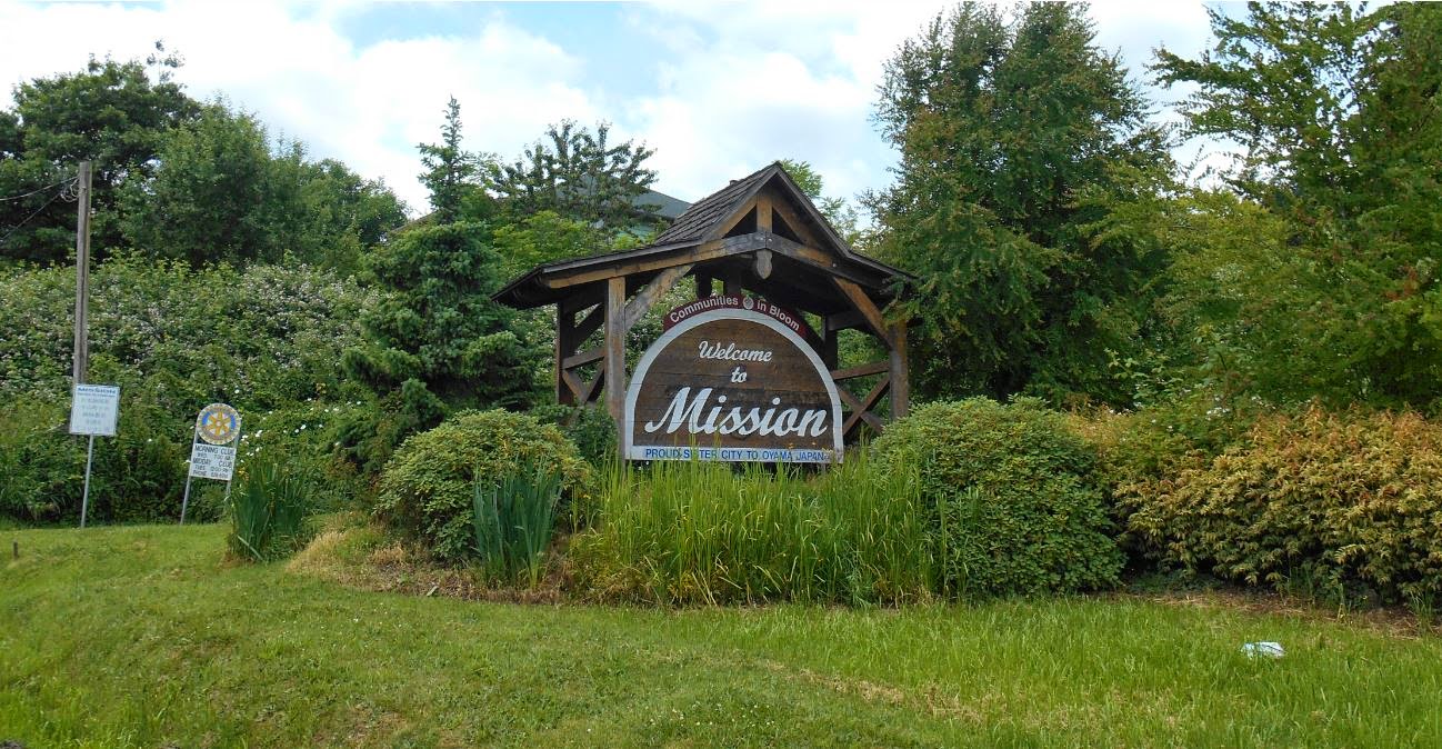
____There was a choice of campgrounds at Hope, along with plenty of cheap motels but Mission is a lot smaller. The claim to fame here is the oldest dwelling in British Columbia; a long-house built by the Sto:lo people. Stuff from nine thousand years ago has been found; proving that salmon fishing and a mild climate made this a good place to live.

____Day 2. The 82 kilometres of the first day make their mark. That and relentless rain cut the day's progress down to 22 kays. Then its straight into Aldergrove's Best Western Hotel and a session in the hot-tub. Finding an old Hayes truck, in a compound beside the Fraser Highway, is the high-light of a damp day. Forty-five inches of rain fall in about 160 days every year in the Fraser Valley, east of Vancouver, so my drenching is not unexpected. I am consoled by the fact that this area has the highest average overall temperature in the whole of Canada.


____Day 3. Cloudy, but dry enough to ride. Fraser Highway, then some off-road tracks; the Mud Bay Trail and the Dyke Trail of Boundary Bay. Heading for the ferry, Tsawwassen to Swartz Bay. To shorten the crossing there is a long spit into the sea. On Vancouver Island, the first town is Sydney and my overnight halt, although it goes to bed at 9 o'clock. Fifty-seven kilometres on the road and about the same on the boat.
____I didn't fancy the ride into the City of Vancouver; at nearly two million inhabitants it's a bit too crowded for me. I know they have a good reputation for being bike-friendly and eco-Greenpeace-green but big cities are not my favorite playgrounds; even if the ride around the sea-wall at Stanley Park is as good as I've been told.
____BC Ferries always have room for a bicycle and its rider; there was no need to book. Journey time is just over an hour and a half for the 24 miles; they leave every hour. The Swartz Bay terminal is a stones throw from Sydney with a campsite between the two. Bike paths are well signposted; all the way to and from the boat.


____Day 4. The Lochside Trail is an old railroad track that is now a cycle-path from Sydney right into to Victoria, the capital city of British Columbia. Riding a bicycle into a big city often gives big problems but it couldn't be any easier than this 36 kilometre southbound run. A lack of city-centre camping has me in a hotel once again. Looks like this trip is not going to be cheap. Lots going on in town as the USS Nimitz is visiting. I ride out to Ogden Point to view the aircraft-carrier; never seen an aircraft-carrier before. A good evening with live music at the Bard and Banker and a cougar on the next bar-stool.
____The Lekwammen people were the first settlers in the Victoria area. The Hudson's Bay Company arrived in 1842 and it didn't take long for them to realise the natural harbour, its pleasant surroundings and the friendly locals made this a perfect spot for a new town. Victoria is still a nice place to live. There is not a lot of industry and the port is mainly for the Canadian Navy; with just the ferry service of the MV Coho, going from the Inner Harbour to Port Angeles in Washington State. Plenty of tourists and plenty going-on around the waterside and the shopping streets that lead inland from the Empress Hotel and the Parliament Buildings.


____Day 5. After the excellent Lochside Trail into the city; I take another old railroad track out. The Galloping Goose Trail, west bound to the town of Sooke. I intended to cut-back across to Duncan on another cross country trail but it has recently been closed to protect the drinking-water catchment area that serves Victoria. The Sooke River Campsite makes a good stop for the night. Sooke is just big enough to have a supermarket and a couple of restaurants. Just 36 kilometres but that seems to be my average.
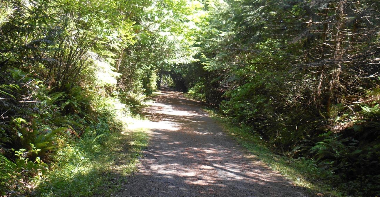
____The Galloping Goose was an old gasoline powered bus that was fitted with wheels to run on railroad tracks in the 1920s. Canadian National Railways ran logging trains on the track and the noisy one-carriage Goose was the passenger transport for the area. The tracks came up and the trail opened in 1989. Like most railroad tracks that become cycle paths; the gradient is very gradual and most of the old trestles are still in place.


____Day 6. A busy logging road with loaded trucks going in both directions. Hilly and twisty, not close to the coast although I am riding on the Pacific Marine Circle Drive. Gastronomic highlight is a visit to Shirley Delicious at Shirley. A fine bakery in the middle of no-where with peacocks. French Beach comes at siesta time; then onto Jordan River which has no services except a walk-in campsite beside the stony beach. Thirty-two kilometres on a busy undulating road.
____The road runs east to west along this section; over-looking the Strait of Juan De Fuca with the United States in view when a gap in the trees affords a sight of the water. Jordan River is a popular spot for surfers despite not being particularly open to the Pacific Ocean. Interestingly; Juan De Fuca was Greek and only worked for Spain as an navigator. He did discover, in 1592, the strait that bears his name whilst searching for the Northwest Passage; however it was not given that name until it was re-discovered in 1797 by Englishman, Charles Barkley.


____Day 7. The second completely dry day of the trip. The roads are much quieter after I pass the log sort-out site belonging to Western Forest Products beside the Jordan River. Todays beach is called Sombrio. Then its onto Port Renfrew and a campsite on one of the few level meadows since I landed on the island. Some steep hills on this 38 kilometre run overlooking the Strait of Juan de Fuca.
____China Beach and Mystic Beach are other options for a quiet time by the water. Plenty of drift wood, a grey jumble of good sized logs that have escaped during the voyage to the sawmill. The Juan De Fuca Marine Trail temptingly runs close to the waterside but was not a possible route for a loaded touring cycle.


____Day 8. It has only been a few years since the road from Port Renfrew to Lake Cowichan has been paved; it has very little traffic. I tackle the ups and downs of the Harris River Canyon in non-stop rain with just a short stop at halfway to look at an eight hundred year old red cedar tree. The guy at the Lake Cowichan Motel says that five hours is a pretty good time for the sixty kilometre haul.
____It would have been nice to stick to the coastline and make my way up to Bamfield. But the route is only for hikers. It is the World famous "West Coast Trail". So popular that you have to book-up to walk it. There were plenty of hikers in the pub, both ready to start and just finished, with me as the only biker.
____A long steep hill, a drenching, mist rolling down from the lumber harvested hillsides and the first day that I dug deep and the body responded with strength and determination. The fitness that I needed was slowly coming back.


____Day 9. The Cowichan Valley Trail is part of an ambitious plan for an off-road pathway that will cross the continent; the Trans-Canada Trail. It still is far from complete; but the old rail road section to Duncan is a good one. A visit to the Tourist Information Centre points me in the direction of Osborne Bay Camping at Crofton. Coast to coast in two days. A laundry day after just 39 kilometres and an early finish.
____I was tempted to stay an extra day and ride round Lake Cowichan. It's about 75 kilometres around the largest freshwater lake on Vancouver Island. A place that calls itself "The Fly-Fishing Capital of the World." Maybe it was the thought of all those fishing hooks flashing backward and forwards across the lakeside road that put me off.


____Day 10. The coast road from Crofton through to the mural city of Chemainus. Many ordinary murals with a few exceptional masterpieces. The murals bring in the tourists that's for sure. Suddenly the left pedal starts making a clicking noise; an irritation rather than a problem. Oak Bay Bikes at Nanaimo soon sort me out some replacements and lend me the tool to change them. Nanoose Bay Campsite is my stop for the night after 69 kilometres; a bit remote and for the first time I worry about a visit from a bear during the night.
____Nanaimo is Vancouver Island's second largest city and growing fast. A ferry port with connections to both Tsawwassen and Horseshoe Bay, north of Vancouver. Originally this area was known for it's deposits of coal; now it is known for the Nanaimo Bar; Canada's answer to Kendal Mint cake.


____Day 11. A short day of just twenty-five kilometres; along the coast road. Camping at Qualicum Beach's River Resort. A busier place and after some of the deserted campsites I have encountered it makes me wonder how some people make a living in the tourist industry. On the way back from the Shady Rest pub; I come across a guy throwing fish-heads onto the stony beach. An eagle swoops in for an easy feed; again and again. I sit at a picnic table taking photographs. Again and again, the guy turns to me and shouts, "Did you get it? Did you get it?"
____Nanaimo seems to be the upper limit to the busy and crowded south-east corner of the island. Although the quieter roads might also be because the main Highway 19 runs inland, parallel to my coast-hugging Highway 19A.


____Day 12. A ham and cheese breakfast before heading back to the other coast, again. Cameron Lake is followed by the old growth trees of Cathedral Grove. Eight hundred year old giants, rare now on Vancouver Island. A long climb over the Port Alberni Summit before swooping down to the Sammoss River, where the sockeye salmon are running. The best run for decades and the river is full of small boats with nets. The Native Americans have the right to fish with nets after so many fish have passed up-stream. They a pulling them out by the dozen. 41 kilometre day.
____Port Alberni calls its-self the "Gateway to the Pacific." The Alberni Inlet is a very long garden-path to the town where paper-mills and lumber-yards give the place an industrial feel. Victoria Quay is the touristy area and a good place to watch the comings and goings on the water. I sat and watched, for over an hour, as a Hong Kong registered freighter was loaded with huge red cedar logs. Stubby little boom-boats nudging logs into place whilst guys walking on the lumber fixed the slings to the cranes.


____Day 13. It's a hundred kilometre ride from Port Alberni to Ucluelet by road but I choose to go by water. Several people have told me about the danger of the twisting, narrow, shoulderless, two-lane highway; it doesn't scare me but the chance to cruise down the fiord-like Alberni Inlet excites me more. The Frances Barkley leaves at eight o'clock; pops into the Sechart Lodge, an old whaling station before dropping me off at Ucluelet, five hours later.
____A fishing port with an industrial edge, a lighthouse and a pub/marina/campsite called the Eagles Nest; complete with whitetail bucks. The third biggest fishing-port in British Columbia; it is busy. A large trawler was tied up at Frances Barkley's disembarkation quay and had to move out into the harbour when we arrived. It spent an hour and a half messing about in the harbour as the Frances Barkley unloaded and re-loaded with everyone tramping over the laid-out fishing nets on the wharf.


____Day 14. A mostly flat road; not that close to the beach. There are off-putting charges to the beaches of the Pacific Rim National Park and some off-putting high prices at some Tofino campsites. I camp at MacKenzie Beach, which has a most-welcome hot-tub. Tofino seems very touristy and markets itself as a storm-watching centre in Winter. A wet Summer's day on a bicycle makes it less attractive than Ucluelet; 40 kilometres down the road.
____Stand-up paddle-boards seem to be all the craze in Tofino. MacKenzie Beach is a good sized cove and pleasant evening stroll with rock-pools at either end and the Best Western Hotel taking up the best spot in the middle. Definitely the best location to watch the Winter storms roll in from the wild Pacific Ocean. Just south of MacKenzie is the 19 kilometres of Long Beach; an undeveloped bit of coast-line with enough driftwood for a hundred log cabins.


____Day15. I pack up the tent in a depressing damp mist before a rainy three and a half hour ride back to Ucluelet to catch the boat back to Port Alberni. A big pool of water is dripped onto the floor of a coffee shop while I kill an hour amongst a crowd of disapproving latte-drinking lap-top users. Crossing the open water before entering the sheltered Alberni inlet; we hit the roughest seas I have ever experienced in a small boat. Rock and roll.
____The area is called the Broken Group Islands and offers sheltered mooring spots for yachts along with an equal measure of submerged rocks; ready to rip the bottom out of anything bigger than a kayak. It's a popular area for scuba-diving thanks to the fifty sunken wrecks that run out of luck. The Frances Barkley again stops to pick-up passengers at the Sechart Whaling Station Lodge. I get a chance to chat with sea-kayakers who rave their paddling on the Pacific Rim. Wilderness camping on deserted islands and gliding silently where on motor-craft dare go. I'm tempted to return, one-day.


____Day 16. The long haul back to the sheltered side of the island and a campsite just along the coast from Qualicum Beach at Dashwood. With an endless stream of trailered aluminuim fishing boats; all heading for the Alberni Inlet on a Saturday morning. Probably a normal working man's best and only chance to get a salmon. A busy campsite with a roadhouse just up the road. Karaoke on Saturday night; some English guys from Essex, good food and you have to get up and sing. House of the Rising Sun and the Metallica version of Whisky in the Jar; I stagger back to the tent at just after mid-night.


____Day 17. A ride along a coastal road mostly by the sea; passing Buckley Bay with its ferry terminal linking it to Denman Island. Not too many hills and plenty of places pop into for a cup of tea. 53 kilometres for the day. Courtney,a large town joined to Comox but no obvious campsite so I take a cheap motel where they insist I take the bike into the room; for safety and security. Highlight of the day was the beachside chainsaw carving show.
____All along my coastal route there are opportunities to take a ferry ride to off-shore islands; Saltspring, Gabriola, Hornby, Texada. I'm tempted to see them all; for I might never come this way again and they are so close. But I stay on Van Isle, I have enough to sees and do in my limited time. Courtney's ferries go to the mainland at Powell River. My last chance to get over before Port Hardy. It is a popular cycle-touring crossing with bikers doing the loop from Vancouver-Powell River-Courtney-Victoria.


____Day 18. A lot of urban sprawl stretched along the 53 kilometres between Courtney and Campbell River but no real hills. I find myself running alongside a tug pulling a barge just off-shore in the Discovery Passage; he just keeps up. Campbell River is a smart town claiming to be the salmon capital of the world; nice fishing pier. The Thunderbird RV Park is the smartest campsite so far. Well laid out with the tent sites shaded be tarps stretched between privacy fences.
____Just three kilometres of water separate Cam River from the mainland and it was this funnel that made it an easy place to catch the huge Chinook salmon. Almost everything in town is fishing orientated but the place is just big enough to have nearly all the big name shops and super-stores. The last such town on the route north. Here the off-shore land is Quadra Island.


____Day 19. The end of urban sprawl; north of Cam River. An early start gets me to Sayward Junction at Noon; to early to set up camp. But as soon as I leave, I know it is a mistake. A seven kilometre hill with a chain-up lay-by at the bottom. Then it is endless false flats all the way to Woss. False flat is when you think you are on the level but in reality you are peddling uphill. It's 8 o'clock in the evening when I reach the tiny hamlet of Woss; completing 131 kays for the day. Biggest day so far; thank goodness there is a motel just off the Highway 19.
____With hind-sight, I should have split the day with a side-trip into Sayward and Kelsey Bay. I'm always put-off by a run down to a coastal village at the end of a dead-end road. Maybe there are no services and there will always be the hard slog back up to the main road. But from what I heard, later, I missed out. An interesting fact about this area is the Mennonite connection. During the Second World War, Mennonite conscientious objectors came an re-planted the Sayward Forest after it had been destroyed by one of Canada's biggest forest fires in 1938. Here I was, a visitor from the Mennonite stronghold of Steinbach, Manitoba, just as the fruits of all that labour was being harvested; 76 years on.


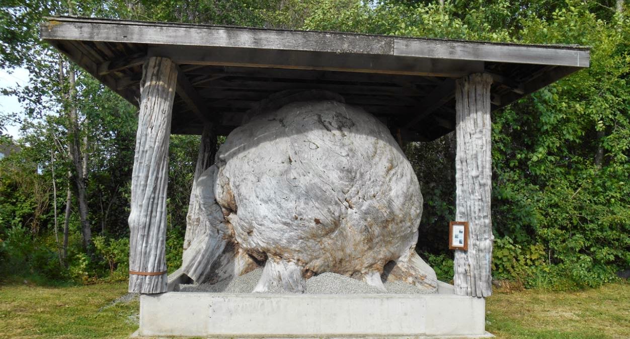
____Day 20.Most map-makers wouldn't bother putting a tiny village such as Woss on the map; but as it is the only place for nearly two hundred kilometres; It gets a mention. Three cycle-tourers are in the café for breakfast; they are heading to Port Hardy and intend to get there in one day. After yesterday's exertions; I settle for Port McNeill, just 67 kilometres away. The map shows the road running alongside Nimpkish Lake but I damned if I saw the thing; similar to those coast roads that run just enough inland that you never see the ocean. Port McNeill; home of the World's Biggest Burl. Another campsite backed onto a forest and signs warning of bears in the area.
____Siontula and Alert Bay are todays possible off-shore excursions. Declined in favour of watching for cruise ships that ply their trade along the narrow Discovery Coast Passage. No-show liners, only ferries and tugs.


____Day 21. Just 37 kilometres to Port Hardy and the boat trip along the Inside Passage. I buy a ticket from the Tourist Information Office; $205 one-way. There are a couple of backpacker hotels in town with reasonable rates. It is a nice town but the ferry terminal is way out of town; because of the early check-in time of 05.30; I camp as close to the quay as possible.
____Victoria is 485 kilometres back down Highway 19; but I've done a lot more than that. No punctures and so far only the pedal problem with the bike. Several rainy days, to be expected but tent hasn't let in a drop and so far I've not seen a single bear. Vancouver Island has been an awesome place to tour by bicycle with such friendly people; I just hope the mainland is going to be as good.


No comments:
Post a Comment